Kaladab · History, Heritage & People
History
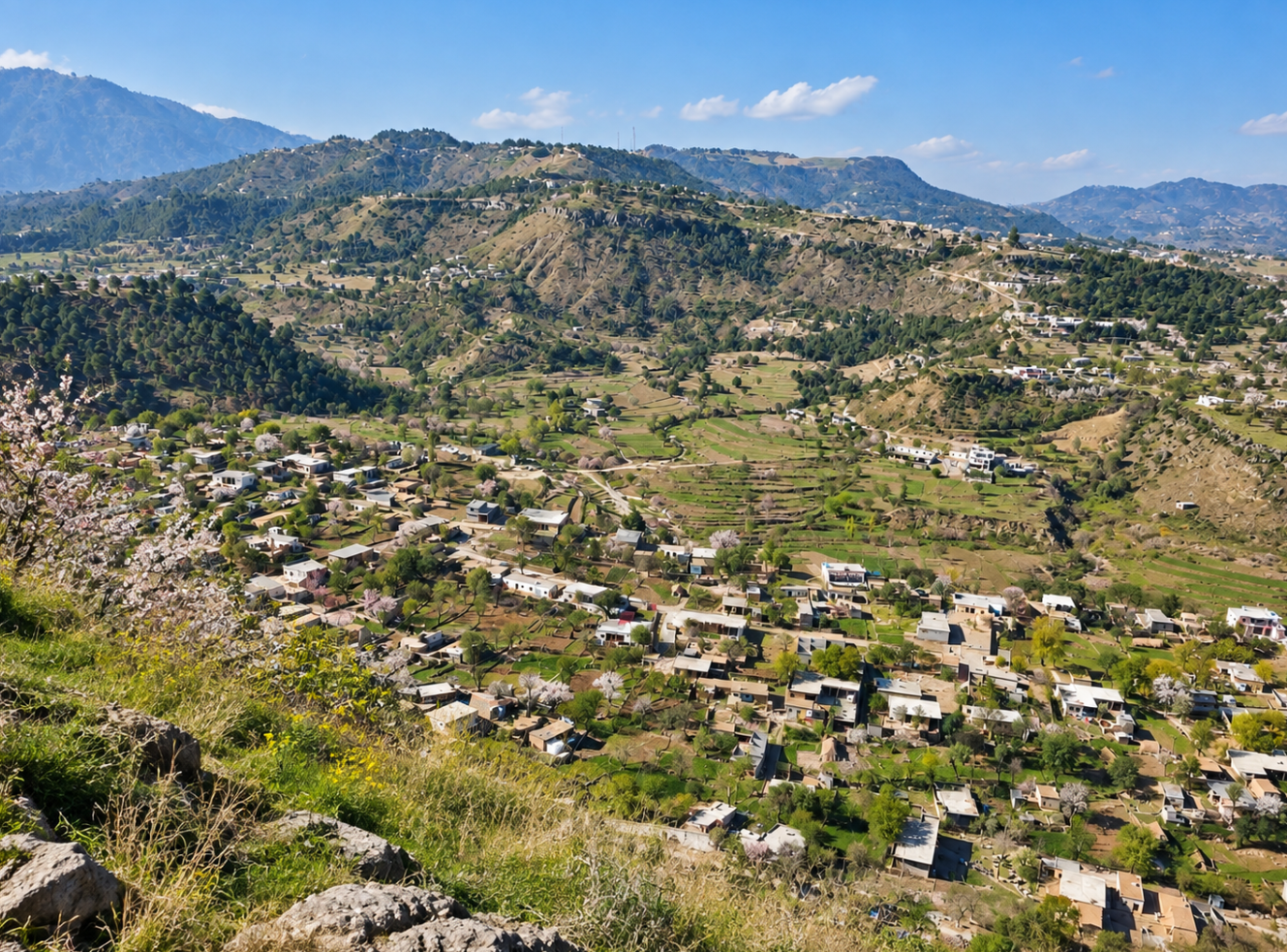
Kala Dab
In the introduction to his work Kashmiris Fight for Freedom, Justice Muhammad Yusuf Saraf writes that Kashmir is like a multi-storeyed building whose courtyard is Punjab. At the beginning are valleys lying between smaller hills, which continue successively towards the magnificent Valley of Kashmir.
These lower mountain ranges form part of the Siwalik Hills, the lower elevations of the Himalayan system, characterised by thorny trees and scrub vegetation. The Siwalik range begins to the east of the River Indus and extends towards Jammu and Kishtwar.

The earliest inhabitants of the Siwalik region were the Gakhars, who have occupied this area for centuries. The history recorded by writers belonging to the Gakhar tribes has, however, been disputed by Sir Lepel Griffin, Firishta and other historians.
The first geographical “storey” of Kashmir and the Siwalik range begins with Jammu, Kishtwar and Chamba, south of the Banihal range, and Mirpur in the west. These regions form the first green mountainous belt north of the Siwaliks and west of Banihal. Beginning west of the Jammu Tawi, this range continues towards the River Jhelum and joins the Pir Panjal range at Kohala. Geographers who have defined the boundaries of this mountain system have written that the Pir Panjal range begins around Shimla and Dalhousie and terminates at Kohala.
Important locations along this mountain range beginning from the Tawi include bari Pattan, Thub, Baghsar Fort, the shrine of Hazrat Baba Shadi Shaheed, Navi Dhar, Pir Gali, Sahar, Barjan and Palak. Here, the range reaches the River Poonch before continuing northwards along the western side of the River Jhelum towards Azad Pattan and Kohala.
The Dadyal area was historically an important part of the Mirpur Jagir and a centre of Gakhar authority. Mirpur and Bhimber are partly mountainous and partly plains, while this geographical belt continues beyond the River Chenab towards Akhnoor, Udhampur and Jammu.
Between Thub and Palak, this mountain range—or natural mountainous wall—has three major gateways, together with numerous smaller paths and passes. The first major gateway is Jandi Chontra, north of Bhimber; the second is Pir Gali; and the third opens beyond Palak alongside the River Poonch, leading through Jarahi, Rajdhani and Gulpur towards Kotli.
Jandi Chontra, Kali Dhar and Pir Gali
Jandi Chontra is a beautiful location situated between Thub and Kali Dhar, between Bhimber and the Samahni Valley.
To the west of Jandi Chontra once stood the lush green mountain of Kali Dhar. Much of what once existed there has now disappeared. Like the Black Forest, this mountain range was once covered with such dense woodland that from a distance it presented a dark, greenish-black appearance. It was because of this appearance that it became known as Kali Dhar — the Dark Ridge.
Pir Gali lies between Kali Dhar and Sahar Wali Dhar. Standing at Pir Gali, one can see the snow-covered peaks of the Pir Panjal to the north. To the south lie Mangla Dam and Mirpur; Rawalpindi lies to the west; Jhelum to the east; while directly ahead are Rohtas and the Salt Range.
From Pir Gali, a road known as the Jammu Road descends towards Pona, an important location in the Samahni Valley. From Pona, the road divides into two routes. One travels east towards Samahni, while the other runs north-east through Tandar and Haripur before joining the Jammu–Poonch Road at Nowshera.
During the Mughal period, these connecting routes were known as Mughal highways, of which there were five in total.
Another road from Pir Gali descends into the Kala Dab Valley, an important area situated near the meeting point of the districts of Kotli, Bhimber and Mirpur.
The Origin of the Name Kala Dab
Kala Dab is a dhok—a small settlement or locality—of the Narmah area. It became known for the large natural pools and exceptionally deep natural wells found in the Khaddal Wala Kas (stream or watercourse). Locally, such deep pools or wells are known as dab, daab or sand.
The Khaddal Wala Kas begins its journey on the western slopes of Bali Mah mountain. It winds around the settlement of Kala Dab before falling into a large dab, an exceptionally deep natural pool or well.
This dab is approximately fifty yards in circumference. It is enclosed by rocky walls on three sides. On its western side, after reaching an average depth of approximately ten to twelve feet, the accumulated water flows onwards into the Khaddal Wala Kas.
There are dozens of other daabs and sands along this stream, but none is as exceptionally deep or filled with such dark-coloured water as Kala Dab.
To the south of Kala Dab runs the road from Mirpur to Khoiratta. At a bend in this road, Raja Feroz Khan built a single-room hotel during the 1960s where locals have constructed a small beautiful mosque now. Beside the hotel, a narrow pathway passes directly above the dab and leads towards the settlement lying at the foot of a branch of Kali Dhar. At this point, the branch becomes known as Kala Dab Wali Dhar.
Another branch of Kali Dhar extending from Pir Gali is known as Sahar Wali Dhar, passing directly in front of the village of Sahar.
There were comparatively fewer pine trees on Sahar Wali Dhar, and these have now been almost completely eliminated by the timber mafia. Some trees still survive on the other branch, although the dense forest has largely disappeared.
The Black Pool and the Landscape of Kala Dab
Khadal Wala Kas divides the settlement of Kala Dab into two sections. Around one part of the settlement, the stream forms a semicircle before falling from a height of approximately fifty feet into Kala Dab—the deep pool of dark water. The other part of the settlement lies west of the stream at the foot of the mountain.
Here stands a vertical rocky cliff approximately one hundred feet high. On top of this towering rock face grows a centuries-old banyan tree. Its shadow falls over the water below, giving the pool an even darker appearance.
The combination of the sheer rocky walls, the great depth of the pool and the shadow cast by the dense tree is the origin of the name Kala Dab—the deep natural pool of dark or black water.
Alongside the cliff supporting the tree runs a narrow pathway leading towards the mountain, Kala Dab Wali Dhar, and the settlement beyond. Because of the height and narrowness of this route, livestock have frequently fallen from above into the dab and died.
The Resin Industry


Until the 1960s, Azad Kashmir had an established pine-resin industry, locally associated with gadda baroza.
Workers known as tappers would lightly strip sections of bark from pine-tree trunks using extremely sharp axes. A strip of tin would then be fixed to the tree with a nail. Beneath this strip, another iron nail supported a small earthenware container made by a potter.
The thick natural oil or resin emerging from the trunk would run down the metal strip and collect in this container.
Approximately every two weeks, the tappers emptied the collected pine resin into tins. Donkey handlers then transported these tins to nearby depots, which were generally established beside roads. From these depots, trucks transported the resin to processing factories.
At the factories, the resin was refined to produce turpentine oil and other products used in medicines, soap-making, paints, matches, fireworks and the textile industry. The residue remaining at the end of the process was used to produce tar for surfacing roads.

In Azad Kashmir, pine forests extend from the mountains around Pir Gali, Kali Dhar, Kala Dab Wali Dhar, Baghsar and Thub towards Rawalakot.
In the districts of Haveli and Bagh, other species of trees, plants, shrubs and vines are also found, including deodar, biar, tangas or tang, walnut, wild rose, timber, akhra, kuth, ban-khor and liquorice.
Pine trees growing beside rivers and streams or on lower hills do not necessarily possess the same capacity to produce resin, owing to climatic conditions.
The principal areas associated with this industry were the Mirpur and Kotli forestry divisions. It should be remembered that forestry divisions are separate from administrative divisions.
Quetta Pine
The Department of Agriculture developed a new variety of pine known as Quetta Pine.
Quetta Pine contributes to the beauty of the landscape and can help mitigate the effects of climate change, but it does not have the capacity to produce commercial resin. The natural oil or resin contained within the tree is instead used in its own growth and development.
Forests and Employment
Forestry and silk production were once major sources of employment in Azad Kashmir.
Thousands of workers—including labourers, utensil makers, blacksmiths, carpenters, donkey handlers and cutters—as well as dozens of truck operators earned a regular livelihood from these industries.
The resin industry itself also contributed significantly to the protection of forests. Each tapper was allocated fifty trees. These trees were formally demarcated and numbered, while Forestry Department staff were responsible for protecting them.
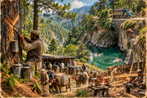
Workers employed on Kala Dab Wali Dhar often came from Hazara. Their depot was situated near Kala Dab, where they stayed and where tins of resin were collected.
Following the example of local people, workers would sometimes jump into the dab. On occasions, the body of a worker would not be recovered until weeks later.
Every year, livestock and forest workers who had come from other areas also fell into the dark waters of Kala Dab and died. The bodies of deceased workers would be placed on trucks and transported back to their homes.
The Watermill of Kala Dab
Along the northern rock face of the dab, a traditional watermill dating back to the Dogra period continued to operate. Such a mill is known locally as a gharāt, and in some areas as a jandar.
This was the fourth watermill situated along the Khaddal Wala stream and was used by local residents to grind grain into flour.
Most women, however, ground flour daily using hand-operated mills installed in their homes, producing enough flour for the family’s daily meals.
The first watermill was situated at Jandroon, while another two mills were located in the Khaddal neighbourhood. The fourth stood at Kala Dab and was powered by water from the stream.
Water emerging from this mill also fell into the dab below, creating the appearance of a waterfall.
Panjan Palahal and the Events of 1947
Historically, the wider area is known as Panjan Palahal, comprising five major villages.
The central village is Panjan Bala, which itself consists of two sections. Its eastern part contains the historic locality of Sabz Kot and the surrounding settlements.
Sabz Kot—referred to simply as “Kot” by Indian military historians—is described as a strategically important location.
According to the account presented in this text, one of the major battles connected with the struggle for Kashmir in 1947 was fought here, and its partial success contributed to the territory that became Azad Kashmir.
Freedom fighter Lieutenant Muzaffar Khan Shaheed, twice awarded the Sitara-e-Jurat, referred to the engagement in his wartime diary as the Jihad-e-Azadi, Battle of Jhangar-Dharamsal. The text states that Indian writers refer to the engagement as the Battle of Nowshera and discuss the military setbacks associated with it.
Streams, Villages and the Geography of Panjan
Water from the eastern side of Panjan Bala flows into Hora Wala Kas. It passes through the village of Hora, Tandar and Moti Taal before joining Sah Wala Kas at Pona.
Sah Wala Kas and She-Kas are fed by water descending from the western part of Panjan.
Sah Wala Kas passes through the villages of Sanyah, Banyah and Sah. Beyond Kaned, it runs along the foothills of Pir Gali and Kali Dhar before joining Hora Wala Kas beyond Pona. From there, it assumes the character of a small river, entering the Samahni Valley before eventually joining the Jammu Tawi.
She-Kas, literally, the “River of Lions”—passes through Panj Chanta, named after a pine tree with five trunks. It then flows along the foothills of Bali Mah and Khandi mountains before joining Khaddal Wala Kas at Kalaytar.
Like Khaddal Wala Kas, these other streams and watercourses also contain dabs and daabs that remain filled with water throughout the year. However, because of its exceptional depth and circular shape, Kala Dab became the best known of them all, and the settlement itself eventually took its name from this natural feature.
The other four villages of Panjan Palahal are Narmah, Palahal Khurd Kalan, Charhoi and Nara Kot.
Narmah
Narmah is an ancient and historically significant village mentioned in historical records.
The village has been inhabited for centuries at the foot of Bali Mah mountain. Sah Wala Kas flows to the east of Narmah, while Khaddal and She-Kas run to its west.
The settlements situated along the slopes of Narmah include Sah, Dublia Rajgan, Khaddal, Jandaron and Kala Dab.
Palahal Khurd and Kalan lies between Khaddal and She-Kas.
Kala Dab Before 1960
Until 1960, Kala Dab was a relatively little-known settlement, and the entire surrounding area formed part of Mirpur District.
During the Dogra period, Kotli was within the administrative boundaries of Mirpur Tehsil. When Kotli was subsequently granted the status of a tehsil, Kala Dab became an important location situated near the meeting point of Kotli, Mirpur and Bhimber.
Until 1960, the entire Narmah area came under Mirpur Post Office.
Each month, a postman travelled from Mirpur, visiting the various settlements and distributing people’s letters and money orders.
In an emergency, anyone wishing to send a telegram had to travel to Jhelum.
Establishment of the Kala Dab Post Office
After 1960, a post office was established at the home of Chaudhry Shah Muhammad in Kala Dab. According to the account, there were two principal reasons for this development.
Before 1947, the late Chaudhry Shah Muhammad had worked for two Hindu moneylender brothers, Bakshi Ishar and Bakshi Lal.
The Hindu businessmen entrusted their land, property and businesses to their trusted employee, Chaudhry Shah Muhammad, before migrating safely to India with their belongings. The account places this event towards the end of 1946.
At the time, conflicting reports concerning the Maharaja of Kashmir were circulating.
After the Bakshi family of Kala Dab left their homes and migrated safely, the two settlements of Kala Dab effectively came under the management and influence of Chaudhry Shah Muhammad.
Since the Dogra period, the shops belonging to Hindu merchants had served as the principal shopping centre for the wider areas of Narmah, Khaddal, Sah and Palahal Khurd & Kalan.
Following 1947 and into the 1960s, people from throughout the surrounding region continued to come to these same shops, which were then operated by the sons of Chaudhry Shah Muhammad.
One reason for establishing the post office there was that whenever someone travelled to the market to purchase household provisions, they could also collect letters for people in their own neighbourhood or village.
The second reason was the improvement in transport connections.
During this period, buses began running from Mirpur through Pir Gali, Sahar and Kala Dab towards Charhoi and, later, Khoiratta.
At Mirpur’s main post office, postal workers would hand mailbags to bus drivers, who carried and distributed the mail along the route through Kala Dab, Sah, Charhoi, Damas and Khoiratta.
During the same period, Mirpur acquired a telegraph system alongside its postal service, and branches of Pakistani banks were also established.
The improvement of these communication systems is attributed in the text to the growing overseas Pakistani community.
Migration to Britain and the Growth of Kala Dab
Thousands of retired servicemen from Mirpur District migrated to England under the voucher system. As remittances began flowing back to the region, the government had to establish and expand postal, telegraph and banking facilities to facilitate the transfer of money.
As the population increased, Kala Dab gradually developed into a town. With the growth of the population and an increase in crime, a police station and a Patwar Khana—the local land-revenue office—were also established.


The History of Kala dab has been thoughtfully researched, written and compiled by Lt Col (R) Mohammad Ayub, a retired Army officer, thinker and author of several books. We are deeply grateful for his valuable contribution towards documenting and preserving the history of Kaladab for future generations.